
MGB flags 106 Cordillera areas at high landslide risk

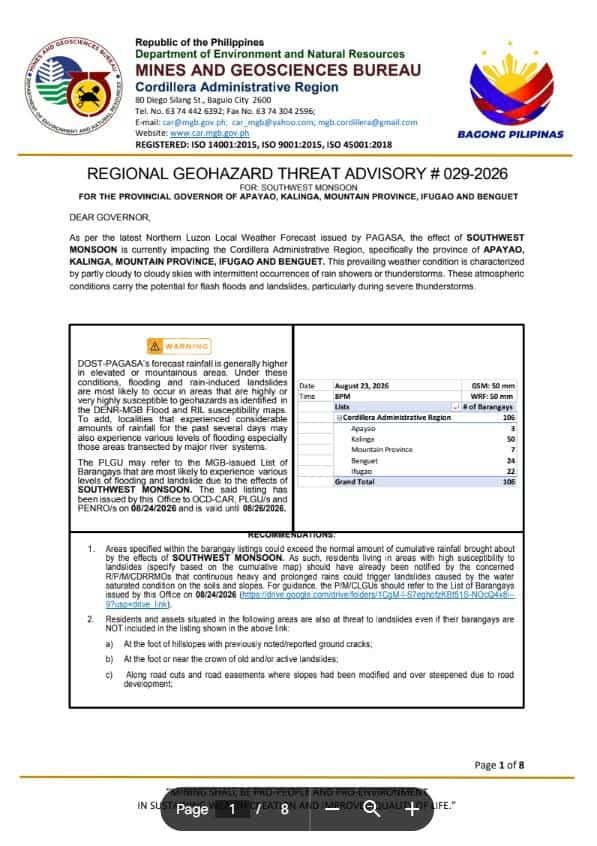
BAGUIO CITY — The Mines and Geosciences Bureau (MGB) has warned residents and local governments in the Cordillera Administrative Region of possible landslides and flash floods as the southwest monsoon continues to bring heavy rains.
MGB Cordillera Regional Director Socrates Gaerlan urged local government units and disaster risk reduction and management councils to closely monitor high-risk communities and conduct preemptive evacuations when necessary.
The bureau identified 106 high-risk areas across the region.
Kalinga has the most with 50 landslide-susceptible areas across Tabuk City and the municipalities of Pinukpuk and Rizal, particularly in Liwan.
Benguet has 24 high-risk areas in Atok, Baguio City, Bokod, Itogon, La Trinidad and Tublay.
Another 22 were identified in Aguinaldo and Alfonso Lista in Ifugao, seven in Paracelis, Mountain Province, and three in Conner, Apayao.
PAGASA forecasts cumulative rainfall of 50 millimeters to more than 200 mm across the Cordillera from 24 to 31 August, with mountainous and high-elevation areas expected to receive heavier localized rainfall.
Continuous rains could further increase the risk of landslides in already susceptible areas.
The MGB advised local authorities to check slope stability, ensure evacuation centers are not themselves exposed to landslides or flooding, and maintain monitoring until weather conditions improve.