
Public can now track local heat index through PAGASA's iHeatMAP
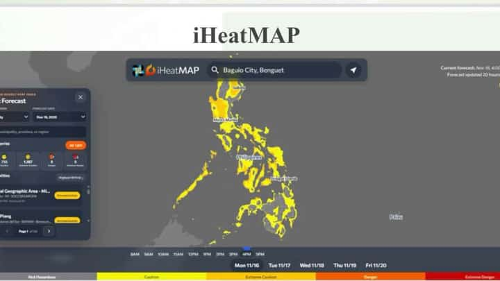
The public can now monitor localized heat index levels across the Philippines through iHeatMAP, an online platform developed by the Department of Science and Technology-Philippine Atmospheric, Geophysical and Astronomical Services Administration (DOST-PAGASA).
PAGASA Baguio Synoptic Station weather observer Engr. Mar Santos said the web-based tool provides high-resolution heat index maps, heat danger classifications and historical temperature data.
The platform allows residents to check heat conditions in their respective areas and take precautions against heat-related illnesses, particularly during periods of extreme temperatures.
The public can access the platform through PAGASA's https://src.panahon.gov.ph/pubfiles/cad/iaas/ihif_new.html" title="iHeatMAP website"/>.
The rollout comes as the country braces for the continuing effects of a very strong El Niño phenomenon, which PAGASA expects to persist into the first half of 2027.
Santos said the weather phenomenon could reach its peak intensity before the end of 2026.
According to PAGASA's climate outlook, most parts of the Philippines are expected to experience below-normal to way-below-normal rainfall through January 2027.
Way-below-normal rainfall conditions are also projected in many areas from February through April 2027, raising concerns over prolonged dry spells and possible drought.
The broader effects of El Niño could continue through the first half of 2027, according to the state weather bureau.
The iHeatMAP platform is expected to help the public monitor heat risks and make informed decisions about outdoor activities as the country prepares for potentially prolonged hot and dry conditions.