
Topic
PhilSA satellite crop mapping
Latest Daily Tribune news and analysis on PhilSA satellite crop mapping.


PhilSA warns ships, aircraft of Korean rocket debris
The Philippine Space Agency (PhilSA) alerts ships, aircraft, and fishing vessels about potential hazards from debris of South Korea's KSLV-II rocket launch,…
· 2 MIN READ

Philippines to launch liquid fueled rocket in 2027
The Philippine Space Agency (PhilSA) is set to launch a liquid-fueled rocket in 2027 in Lal-lo, Cagayan, boosting local aerospace expertise in partnership with…
· 4 MIN READ

DA, PhilSA tap satellites for food security
The DA and PhilSA will use satellites, AI and geospatial data to detect farm damage, improve irrigation planning and strengthen food security.
· 2 MIN READ
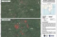
PhilSA maps possible quake-triggered landslides in Mindanao
PhilSA is using Sentinel-2 satellite data to map possible earthquake-triggered landslides in Mindanao after the magnitude 7.8 quake, identifying about 137.87…
· 1 MIN READ
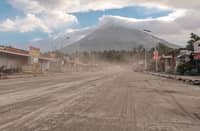
More than 1,200 hectares at risk from Mayon ashfall
The Philippine Space Agency reports that over 1,200 hectares of farmland around Mayon Volcano, including rice and other crops, may have been affected by…
· 1 MIN READ
Air pollution across metro persists, says PhilSA
The Philippine Space Agency reported persistent air pollution over Metro Manila nearly two weeks after the Navotas landfill fire, with satellite data showing…
· 2 MIN READ

BSP, PhilSA seal satellite data pact for climate risk
BSP and PhilSA sign a deal to use satellite imagery and geospatial data to enhance climate risk monitoring and strengthen financial system resilience.
· 2 MIN READ
Satellite tech offers clearer picture of flood, drought damage to rice farms
Satellite-based Earth Observation technology can improve assessment of flood and drought damage to rice farms, aiding forecasts, insurance design, and farmer…
· 1 MIN READ