
DepEd eyes AI, school-level data to reduce blanket class suspensions

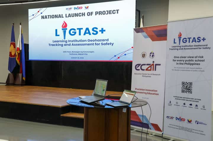
Education Secretary Sonny Angara led the nationwide launch of Project LIGTAS+, an AI-driven platform that tracks real-time geohazard risks to safeguard schools and prevent disaster-driven learning losses. Secretary Angara stressed the need to move from passive resilience to proactive disaster management, ensuring that local officials have actionable intelligence to protect learners and maintain learning continuity before hazards escalate into crises.
DepEd PH
The Department of Education (DepEd) is looking to use artificial intelligence and school-level disaster risk data to reduce blanket class suspensions, allowing authorities to determine which campuses should close based on their actual exposure to hazards.
DepEd Undersecretary for Governance and Operations Malcolm Garma said Wednesday that the department would use data generated by Project LIGTAS+ to inform decisions on interventions and disaster responses at individual schools.
“Pagsasama-sama ng mga campus para gawin nating basehan ng ating mga desisyon, mga programang intervention na puwede nating gawin sa mga eskwelahan,” Garma told reporters during the national launch of Project LIGTAS+ in Makati City.
The platform, or Learning Institution Geohazard Tracking and Assessment for Safety, uses geospatial analytics, satellite imagery, historical hazard data and artificial intelligence to generate school-specific risk profiles. It monitors more than 48,000 public schools across multiple hazards, including floods, earthquakes, typhoons, landslides, volcanic activity, storm surges and extreme heat.
Garma said the system could help DepEd determine whether a school in a disaster-affected locality needs to suspend classes while allowing other campuses that are not directly at risk to continue operating.
“For example, ang division offices natin or regional offices natin can provide support sa mga schools natin. But of course, definitely, it will depend sa sitwasyon ng kalamidad natin,” he said.
He said the system would be particularly useful when risks can be assessed at the school level, but infrastructure limitations could prevent its immediate use in areas severely affected by disasters.
“Lalo kung pagbaha ito, paglindol, hindi magaya talaga, then we'll have to really wait for the infrastructure to improve para mas magamit natin itong platform na ito,” Garma said.
Project LIGTAS+ was developed by DepEd's Disaster Risk Reduction and Management Service in partnership with the Education Center for AI Research. The platform provides interactive multi-hazard maps, flood intelligence based on satellite radar data, earthquake impact assessments, volcanic monitoring and AI-powered weather forecasts of up to 10 days.
Garma said DepEd is also preparing recommendations for inspections of schools, although the department has yet to determine whether these would be carried out through an executive order or memorandum circular.
“Waiting for the final decision kung ano ang instrumentality yung gagamitin. But we have already drafted the recommendations,” he said.