
Habagat weakens but heavy rains still possible over Luzon

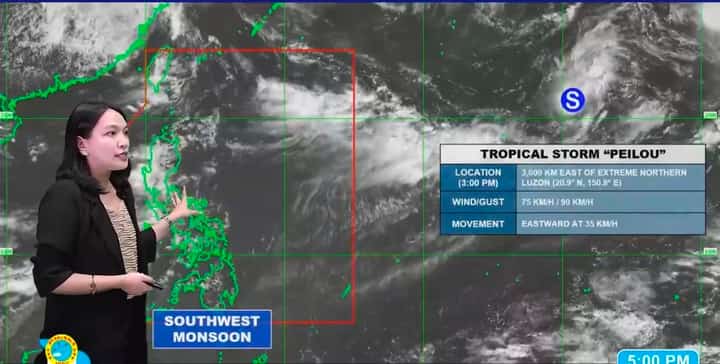
The southwest monsoon, or Habagat, is no longer expected to be as enhanced as in previous days when Typhoon Dolphin strengthened the weather system, but heavy rains could still affect parts of Luzon, PAGASA said Monday.
“Ini-expect natin hindi na ganon ka-enhance ang Habagat unlike noong mga nakaraang araw kung saan pinapalakas ito ng Bagyong Dolphin,” PAGASA weather specialist Grace Castañeda-Carpio said during the 5 p.m. weather update.
“Pero medyo marami pa rin po yung dala nitong ulan. Posible pa rin po hanggang malakas ang pag-ulan na mararanasan, lalo na dito sa Zambales, Bataan at Occidental Mindoro,” she added.
PAGASA said sudden downpours could also affect La Union, Pangasinan, Benguet, Tarlac, Pampanga, Bulacan, Metro Manila, Rizal, Cavite and parts of Batangas on Monday evening.
Castañeda-Carpio said a large portion of Luzon, particularly its western section, remained covered by clouds associated with the Habagat.
PAGASA monitors Tropical Storm Peilou
Meanwhile, PAGASA is monitoring Tropical Storm Peilou outside the Philippine Area of Responsibility.
Peilou was last spotted about 3,000 kilometers east of extreme Northern Luzon, packing maximum sustained winds of 75 kilometers per hour and gusts of up to 90 kph.
“Pasilangan po ito at palayo sa ating Philippine Area of Responsibility,” Castañeda-Carpio said.
“Wala rin tayong ine-expect na magiging direct effect nito sa anumang bahagi ng ating bansa,” she added.
PAGASA said the tropical storm is moving away from the PAR and is not expected to directly affect the country.