- NEWS
- the EDIT
- COMMENTARY
- BUSINESS
- LIFE
- SHOW
- ACTION
- GLOBAL GOALS
- SNAPS
- DYARYO TIRADA
- MORE

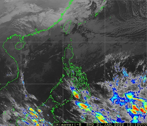
A low-pressure area has developed over the waters of Northern Mindanao, according to the state weather bureau Philippine Atmospheric, Geophysical and Astronomical Services Administration (PAGASA).
As of 8 a.m., the LPA was spotted at 1,240 kilometers, east of Northeastern Mindanao, near the boundary of the Philippine Area of Responsibility.
PAGASA said that the weather system has a “low” chance of developing into a tropical cyclone in the next 24 hours.
The trough, or the extension of the low-pressure area, is forecasted to bring isolated rainfall over Eastern Visayas and eastern portion of Mindanao.
Once the low-pressure area strengthens into a tropical depression, it will be given a local name of Auring, the first storm for 2025.
Meanwhile, the western section of Luzon, specifically the provinces of Batanes, Babuyan islands, Zambales, Bataan, and areas of Ilocos region, Cordillera region will experience rains due to the southwest monsoon.
Last Wednesday, the state weather bureau issued a tropical cyclone formation, which shows that from 4 June to 10 June, a tropical cyclone like vertex will form over the Pacific Ocean, which will move in a northwestward direction.
There is no gale warning raised within the seaboards in the country.
