- NEWS
- the EDIT
- COMMENTARY
- BUSINESS
- LIFE
- SHOW
- ACTION
- GLOBAL GOALS
- SNAPS
- DYARYO TIRADA
- MORE

The state weather bureau said Monday that thunderstorm occurrences during the afternoon and nighttime could become more common in the coming days and weeks due to the southwest monsoon.
PAGASA’s Weekly Weather Forecast, issued last Friday, noted that starting Wednesday, 28 May, rain-bearing clouds from the southwesterly wind flow could affect the Ilocos Region, Zambales, and Bataan.
“In the coming days or weeks, the southwest monsoon—or habagat—may begin to prevail, which could lead to more frequent thunderstorms in the afternoon or evening,” PAGASA Weather Specialist Obet Badrina said.
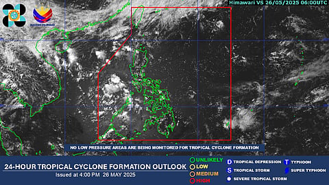
He noted that despite the occurrence of thunderstorms, no tropical cyclones or low-pressure areas have been detected within the Philippine Area of Responsibility.
According to PAGASA’s forecast, the intertropical convergence zone (ITCZ) and the easterlies are currently affecting the country.
The ITCZ is expected to bring rainfall over the Zamboanga Peninsula, Western Visayas including the Negros Region, and Palawan.
Rainfall is also expected over the remaining parts of Mindanao; however, it is forecast to be lighter than in previous days.
Meanwhile, isolated rains are expected over the Batanes Islands due to the frontal system, while the rest of Luzon is forecast to experience humid conditions due to the easterlies.
