
LPA spotted outside PAR
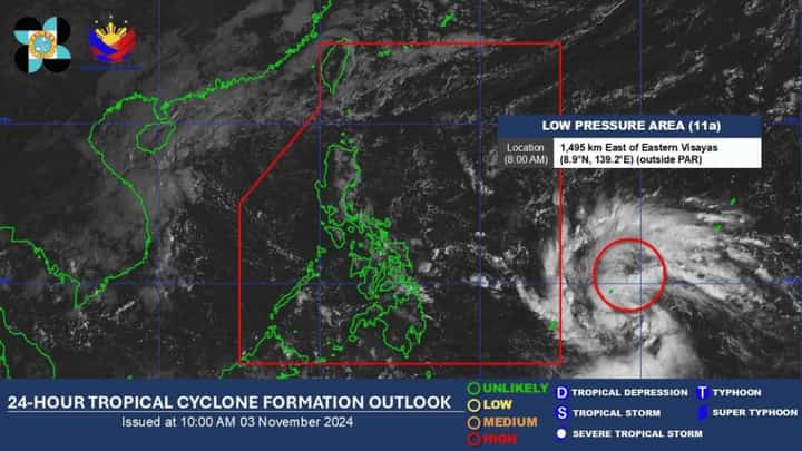
A low-pressure area across the Pacific Ocean might intensify into a tropical depression, the state weather bureau said this Sunday.
As of 10 a.m., the low-pressure area was last spotted 1,495 kilometers east of Eastern Visayas, which is still outside the Philippine Area of Responsibility (PAR).
It is expected to intensify into a tropical depression within 24 hours, the Philippine Atmospheric, Geophysical and Astronomical Services Administration (PAGASA) said.
Upon its entry into the PAR, it will be given the local name “Marce.”
According to the Joint Typhoon Warning Center, the low-pressure area is expected to move northwest towards Luzon.
The same trajectory is also shown by Windy.com, indicating a northwestward movement.
PAGASA weather forecaster Benison Estareja noted that most November storms usually make landfall and these storms could reach typhoon or even super typhoon category.
But based on PAGASA’s Tropical Cyclone Threat Potential, from 3 to 9 November, a storm is expected to move towards Northern Luzon.
In the following week, there is a low chance of another two storms developing across the Pacific, it added. Still,
the weather bureau did not share any information regarding its expected strength.