- NEWS
- the EDIT
- COMMENTARY
- BUSINESS
- LIFE
- SHOW
- ACTION
- GLOBAL GOALS
- SNAPS
- DYARYO TIRADA
- MORE

KATHMANDU, Nepal (AFP) — Every morning, Nepali primary school teacher Bina Tamang steps outside her home and checks the rain gauge, part of an early warning system in one of the world’s most landslide-prone regions.
Tamang contributes to an artificial intelligence (AI)-powered early warning system that uses rainfall and ground movement data, local observations and satellite imagery to predict landslides up to weeks in advance, according to its developers at the University of Melbourne.
From her home in Kimtang village in the hills of northwest Nepal, 29-year-old Tamang sends photos of the water level to experts in the capital Kathmandu, a five-hour drive to the south.
“Our village is located in difficult terrain, and landslides are frequent here, like many villages in Nepal,” Tamang told Agence France-Presse (AFP).
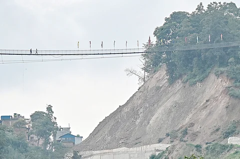
Every year during the monsoon season, floods and landslides wreak havoc across South Asia, killing hundreds of people.
Nepal is especially vulnerable due to unstable geology, shifting rainfall patterns and poorly planned development.
Early warnings
Tamang’s data is handled by technical advisers like Sanjaya Devkota, who compares it against a threshold that might indicate a landslide.
“We are still in a preliminary stage, but once we have a long dataset, the AI component will automatically generate a graphical view and alert us based on the rainfall forecast,” Devkota said.
“Then we report to the community, that’s our plan.”
The experts have been collecting data for two months, but will need a data set spanning a year or two for proper forecasting, he added.
Eventually, the system will deliver a continuously updated landslide risk map, helping decision makers and residents take preventive actions and make evacuation plans.
The system “need not be difficult or resource-intensive, especially when it builds on the community’s deep local knowledge and active involvement,” Tordesillas said.
The landslide forecasting platform was developed by Australian professor Antoinette Tordesillas with partners in Nepal, Britain and Italy.
Its name, SAFE-RISCCS, is an acronym of a complex title — Spatiotemporal Analytics, Forecasting and Estimation of Risks from Climate Change Systems.
“This is a low-cost but high-impact solution, one that’s both scientifically informed and locally owned,” Tordesillas told AFP.
Professor Basanta Adhikari from Nepal’s Tribhuvan University, who is involved in the project, said that similar systems were already in use in several other countries, including the United States and China.
“We are monitoring landslide-prone areas using the same principles that have been applied abroad, adapted to Nepal’s terrain,” he told AFP.
“If the system performs well during this monsoon season, we can be confident that it will work in Nepal as well, despite the country’s complex Himalayan terrain.”
In Nepal, it is being piloted in two high-risk areas: Kimtang in Nuwakot district and Jyotinagar in Dhading district.
