- NEWS
- the EDIT
- COMMENTARY
- BUSINESS
- LIFE
- SHOW
- ACTION
- GLOBAL GOALS
- SNAPS
- DYARYO TIRADA
- MORE

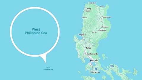
The West Philippine Sea, a portion of the disputed South China Sea, is now searchable on Google Maps, a web mapping platform and consumer application developed by Google.
Filipino netizens were quick to notice the appearance of the label on Monday, although the American multinational corporation and technology company has not confirmed exactly when it was added to the platform.
The WPS refers to the waters within the Philippines’ 200 nautical miles exclusive economic zone.
The term was officially adopted in 2012 through Administrative Order No. 29 issued by then-President Benigno “Noynoy” Aquino III. The order designated the Luzon Sea and the waters around, within, and adjacent to the Kalayaan Island Group and Bajo de Masinloc as the WPS.
The Ayungin Shoal, also known as Second Thomas Shoal, a low-tide elevation on the WPS, has become one of the points of contention between the Philippines and China in the recent years due to their overlapping claims in the area.
Located 105 nautical miles west of Palawan, Ayungin Shoal is considered part of the Philippines' exclusive economic zone and continental shelf.
In 2016, the Philippines won a landmark arbitration case against China before the Permanent Court of Arbitration. The ruling invalidated China's expansive claims in the South China Sea.
China has rejected the award, calling it “illegal, null and void.”
