- NEWS
- the EDIT
- COMMENTARY
- BUSINESS
- LIFE
- SHOW
- ACTION
- GLOBAL GOALS
- SNAPS
- DYARYO TIRADA
- MORE

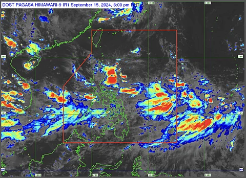
State weather bureau Philippine Atmospheric, Geophysical and Astronomical Services Administration on Sunday revealed that there are two active low-pressure areas in the Philippine Sea.
As of 2 p.m., the first low-pressure area was last spotted 440 kilometers east of Casiguran, Aurora, while the other is 2,145 kilometers east of Eastern Visayas, which is still outside of the Philippine Area of Responsibility.
Based on the PAGASA’s bulletin, the closer low-pressure area has a low chance of developing into a storm, while the other has a medium chance of intensifying further.
The southwest monsoon continues to bring moderate to occasionally heavy rainfall in the areas of Palawan and Visayas.
The low-pressure area near the Northern Luzon landmass is expected to bring scattered rainfall in the areas of the Cagayan Valley area.
Once it develops into a tropical depression, it will be given the local name of “Gener.”
The agency also noted that the two low-pressure areas might enhance the southwest monsoon that can bring rainy weather to the western seaboard of the country.
The southwest monsoon continues to bring moderate to occasionally heavy rainfall in the areas of Palawan and Visayas.
The areas of Negros Occidental, Antique, Iloilo, Palawan, and Occidental Mindoro were listed under rainfall warnings due to the enhanced southwest monsoon.
The Office of the Civil Defense has warned of possible lahar flow in the areas near Mount Kanlaon in Negros island as the volcano remains under Alert Level 2.
