
‘Bebinca’ intensifies, may enter PAR Friday
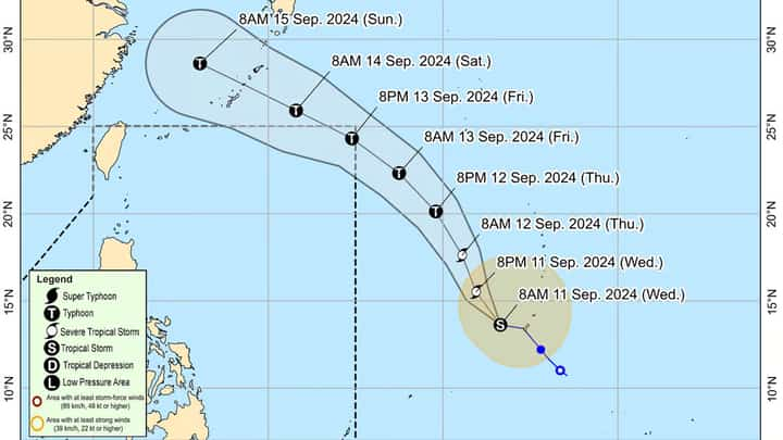
Tropical storm “Bebinca” continuously intensifies moving away from Guam and is seen to intensify into a severe tropical storm within 24 hours, said Philippine Atmospheric, Geophysical and Astronomical Services Administration on Wednesday.
It is expected to develop into a typhoon late Thursday.
In its monitoring as of 11a.m., “Bebinca’s” center was estimated at 1,825 km northeast of Eastern Visayas or 1,955 km east of Southeastern Luzon.
“Bebinca” recorded maximum sustained winds of 85 km/h near the center, gustiness of up to 105 km/h, and a central pressure of 992 hectoPascals (hPa).
Hence, the state weather bureau warned of strong to gale-force winds that may extend outwards up to 480 km from the center.
“Bebinca” is forecast to track generally northwestward on Wednesday night through Friday evening then west northwestward for the remainder of the forecast period, said PAGASA.
It is expected to enter PAR on Friday afternoon or evening and exit PAR on Saturday morning.
“Despite being far from the Philippine landmass and not directly affecting the country, “Bebinca” is forecast to enhance the southwest monsoon, which may bring heavy rainfall over Bicol Region, MIMAROPA, Visayas and the northern and western portions of Mindanao,” PAGASA added.