- HEADLINES
- NEWS
- PAGE THREE
- COMMENTARY
- BUSINESS
- LIFE
- ACTION
- GLOBAL GOALS
- SNAPS
- DYARYO TIRADA
- MORE

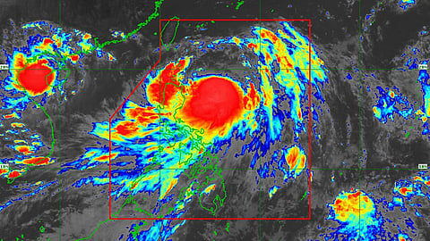
Typhoon Carina (international name: Gaemi) is weakening and is now over southeastern China, according to the state weather bureau PAGASA.
In its latest bulletin, the typhoon has been monitored as moving west-southwestward at a 10-kilometer per hour (km/h) pace.
As of 4:00 PM, ‘Carina’s center was estimated at 550 km north-northwest of Itbayat, Batanes, with maximum sustained winds of 120 km/h near the center, gustiness of up to 180 km/h, and a central pressure of 975 hectoPascals (hPa).
A warning of strong to typhoon-force winds remains, which may extend outwards up to 640 km from the center.
Super Typhoon Carina weakened to a typhoon on Wednesday evening as it lopped near the coast of Taiwan.
It exited the Philippine Area of Responsibility (PAR) at 6:20 a.m. on Thursday.
Tropical Cyclone Wind Signal No. 1 is still hoisted over Batanes, with the possible occurrence of strong winds that may pose minimal to minor threats to life and property.
‘Carina’ is the third tropical storm to enter the PAR this year, as tropical depression (TD) Butchoy left the PAR last Saturday, 20 July.
TD Aghon intensified into a tropical storm last May, making it the first tropical cyclone in the country this year.
