- NEWS
- the EDIT
- COMMENTARY
- BUSINESS
- LIFE
- SHOW
- ACTION
- GLOBAL GOALS
- SNAPS
- DYARYO TIRADA
- MORE

Not so fast, Taguig City. Hold off on the celebratory toasts and the victory cigars.
Pateros Mayor Fernando Miguel "Ike" Ponce asserted yesterday that Taguig City cannot as yet celebrate a Supreme Court ruling that handed it control over the 10 so-called enlisted men's barrios, or EMBOs.
Likewise, the Cayetanos of Taguig should refrain from counting on the revenues the city could get from Bonifacio Global City after the SC stripped Makati City of control over it and the EMBOs.
For Mayor Ponce, the EMBOs and BGC, built on military reservations that the national government allegedly took from the town decades back, belong neither to Taguig nor Makati but to Pateros.
"Actually, in the oldest map that we hold, it's clear that jurisdiction over BGC (and the EMBOs) lies with Pateros because they're inside our town," Ponce told Dyaryo Tirada's digital show Hot Patatas on Friday.
"That's very clear from the original map," he added in Filipino, stressing that they have strong evidence showing that the 10 EMBOs were in Pateros, which had original jurisdiction up to the foot of Guadalupe Bridge straddling the boundary of Mandaluyong City.
He said their proof would support their entitlements to BGC, the EMBOs, and the areas near Guadalupe. "That (Guadalupe) would be inside our boundaries (based on the original map)," he asserted.
1800s onward
Ponce said that dating back to the 1800s, Pateros had a land area of 1,040 hectares based on official government data, including from the agency that preceded the Philippine Statistics Authority.
"Even if you go now to the PSA, they'll certify our land area to be 1,040 hectares," the mayor pointed out. "If we go back through history, from the 1800s up to the present, you will see the actual areas of Pateros."
He said the town's land area had been fluctuating since then from 1,040 hectares to 983 hectares and then 843 hectares.
"If you would believe it, our land area now in Pateros is only 168 hectares," he lamented.
Ponce said that from 1,040 hectares, Pateros' land area shrunk to 168 hectares because the national government converted their territory into a military reservation, starting Taguig's efforts to take Pateros' land.
When the military reservations were returned, they were not given back to their "rightful owner, Pateros," the mayor said.
He said the Armed Forces of the Philippines, which used the military reservations, and the Office of the President, as the representative of the national government, should have returned the land to Pateros.
"Yes, that's true. Let's include the national government as represented by the Office of the President," he said, explaining that a proclamation by then-President Ferdinand Marcos Sr. opened the military reservations to public disposition but erroneously identified the areas as belonging to the then-town of Makati.
"That's the proclamation that both Pateros and Taguig wanted to nullify," he said, referring to Proclamation 2475, signed by Marcos Sr. in January 1986, which stated that Fort Bonifacio "is situated in Makati and it is open for disposition."
Fight with Taguig
Because of that proclamation, Makati, Taguig, and Pateros had a boundary dispute dating back to the 1990s when Pateros sought the return of the land that belonged to it, Ponce said.
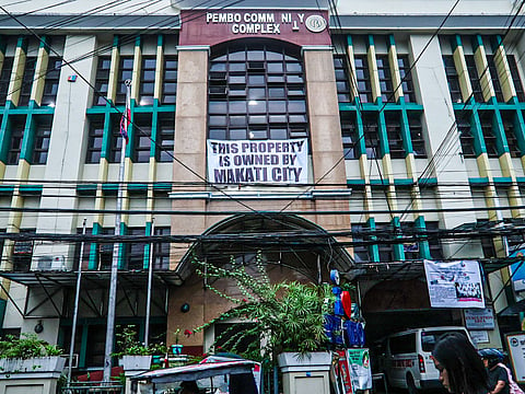
Among the EMBOs are Comembo, Pembo, East Rembo, West Rembo, Cembo, South Cembo, Pitogo and Rizal, which became part of Makati and BGC (known then as Post Proper Northside and Post Proper Southside of Makati; and Mamanca, Masilang, San Nicolas and Malapad Na Bato belonging to Pateros).
Ponce said all of the facts can be gleaned from the documents and official maps secured by former Pateros Councilor Dominador Rosales from libraries and agencies, including the US Library of Congress and American archives.
Among the documents is the 1968 Land Classification Map of the Bureau of Land, which is central to the case filed by Pateros against Taguig that has remained pending in the Supreme Court.
"As the land that had been awarded to Taguig and Makati is already out of the issue, we are now concentrating on our fight with Taguig," Ponce said.
"Our case is very much alive, and Taguig has filed a motion for reconsideration. I believe their motion would not amount to anything because all they have are rehashed arguments," the mayor added.
Pateros is the only town among the 16 cities comprising Metro Manila or the National Capital Region. Pateros' history and land are so intertwined with Taguig that they share a common representative in Congress.
