
Heavy rains beginning Saturday due to TD ‘Neneng’
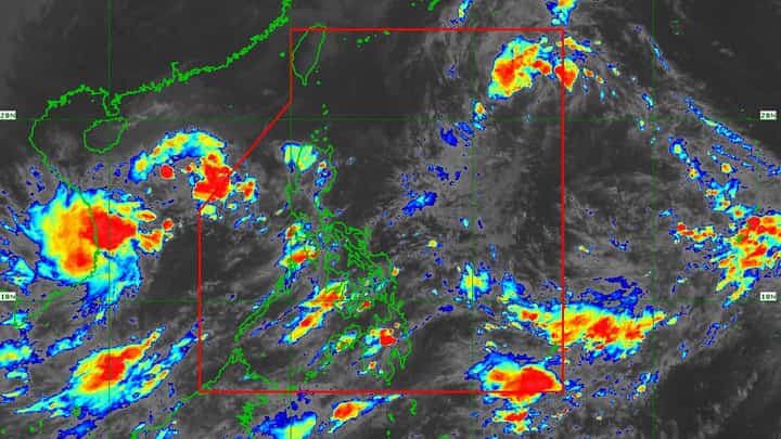
The Philippine Atmospheric, Geophysical, and Astronomical Services Administration said heavy rains will prevail over Northern Luzon beginning Saturday due to the passage of tropical depression "Neneng" as it entered the Philippine area of responsibility on Thursday afternoon.
In its weather advisory on Thursday, 13 October, PAGASA said 'Neneng' will bring cloudy skies with scattered rains and thunderstorms over the Cagayan, Apayao, Isabela, and Ilocos Norte.
While Metro Manila and the rest of the country will experience isolated rains and thunderstorms with possible flash floods or landslides.
'Neneng', which was last spotted 1,050 km east of Extreme Northern Luzon, packing maximum sustained winds of 55 kilometers per hour near the center and gustiness up to 70 kph and it is moving westward at 30 kph.
PAGASA sees 'Neneng' will reach the tropical storm category on Friday. It is the 14th tropical cyclone to hit the country.
Meanwhile, former tropical depression 'Maymay' has weakened into a low-pressure area on Thursday. However, it will still bring moderate to heavy rains on Friday over the Cagayan, Isabela, and Apayao. While light to moderate with at times heavy rains over the rest of Cagayan Valley and Cordillera Administrative Region.
Despite the lifting of wind signals, PAGASA said 'Maymay' will affect occasional gusts reaching strongly to gale-force strength associated with the enhanced northeasterly surface wind flow may still be experienced (especially in the coastal and mountainous areas) over Batanes, Cagayan, CAR, and Ilocos Region.
Rough to very rough seas up to 2.8 meters to 5.5 m will prevail over the seaboards of Northern and Central Luzon and the eastern seaboard of Southern Luzon due to the surge of northeasterly surface wind flow by the LPA.
While moderate to rough seas of 1.5m to 3.5 m will prevail over the western seaboards of Central and Southern Luzon.
PAGASA warned these conditions may be risky for those using small seacrafts. Thus, mariners and seafarers are advised to take precautionary measures when venturing out to sea. If possible, prevent navigating seas under these conditions.
The remnant circulation of 'Maymay' —which was last tracked over the coastal waters of Casiguran, Aurora—is forecast to track westward towards Aurora. This may dissipate within 12 hours from Thursday, due to the frictional effects.