The low-pressure area which was tracked over the Eastern Visayas is seen to develop into a tropical depression within 72 hours, the Philippine Atmospheric, Geophysical, and Astronomical Services Administration said Tuesday.
PAGASA said hazards affecting land areas are expected in the next 24 hours.
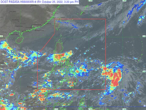
Moderate with at times heavy rains will prevail over the Cagayan, Isabela, Apayao, the rest of Central Luzon, Metro Manila, Rizal, Laguna, Central Visayas, Caraga region, and Northern Mindanao due to shear line and intertropical convergence zone.
Floodings and rain-induced landslides are possible during these weather conditions.
Scattered rains and thunderstorms are also expected in Palawan, Visayas, and Mindanao due to ITCZ, while Cagayan, Isabela, Aurora, and Quirino will be affected by the shear line.
Meanwhile, the Ilocos Region, Cordillera Administrative Region, the rest of Cagayan Valley, and the rest of Central Luzon will experience isolated light rains due to Northeast Monsoon or "Amihan" with no significant impact expected.
Isolated rain showers or thunderstorms will be over Metro Manila and the rest of Luzon due to localized thunderstorms.
Moderate to strong wind speed directing Northeast will be experienced in Northern Luzon and the eastern section of Central Luzon while the rest of the country has light to moderate winds, directing Northeast to Northwest.
The temperature will range from 24.4 °C at 6 a.m. to 33.0 °C at 2 p.m. with 52 to 95 percent of relative humidity.
